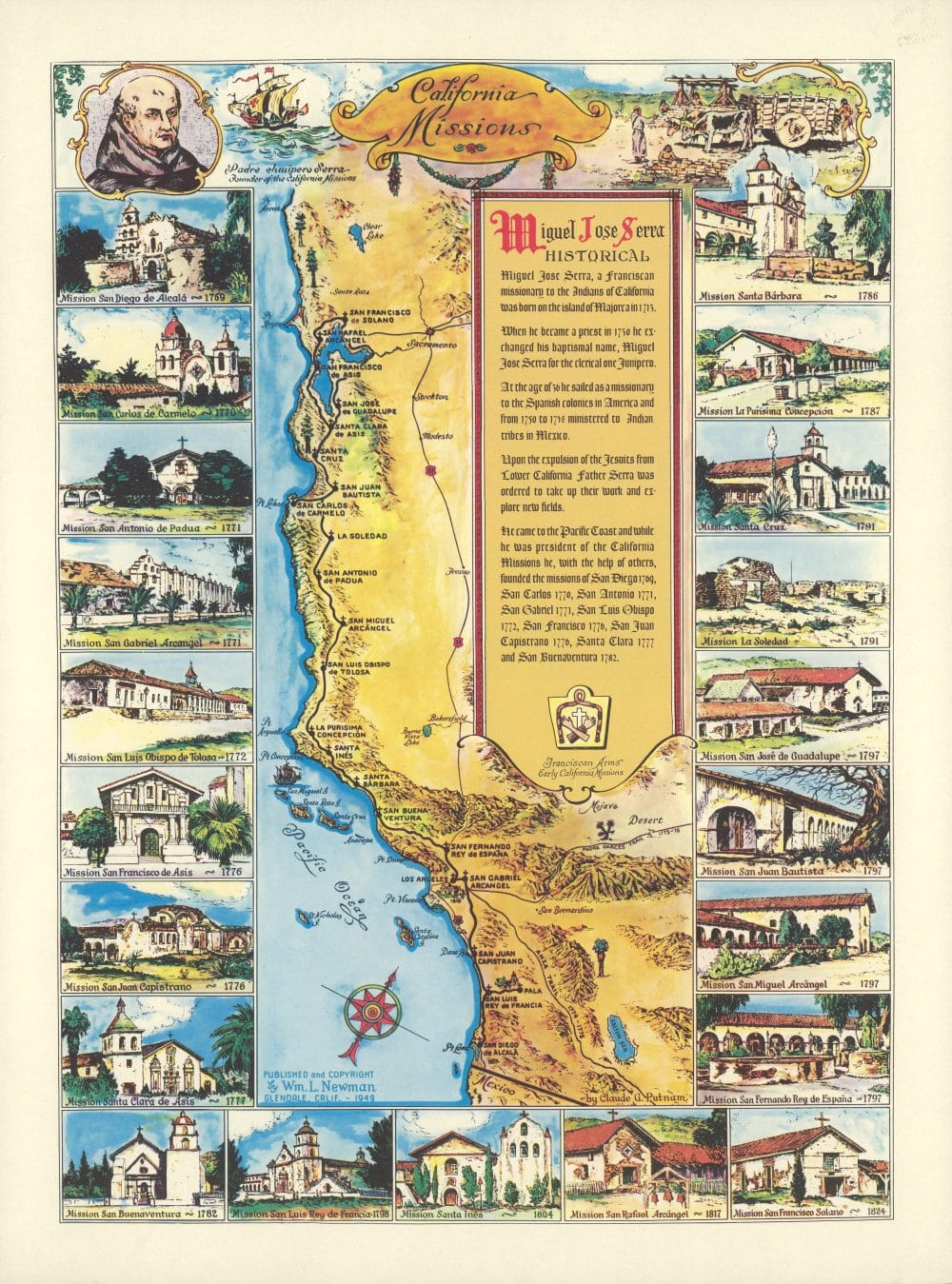
California Missions by Claude G. Putnam
Author: Putnam, Claude George
Date: 1949
Short Title: California Missions
Publisher: Wm. L. Newman
Publisher Location: Glendale, Calif.
Type: Separate Map
Full Title: California Missions. By Claude G. Putnam. Published and copyrighted by Wm. L. Newman. Glendale, Calif. – 1949.
Pub Note: Color pictorial map of California, showing the location of missions, with a brief history of the many missions founded by Miguel Jose Serra. By Claude George Putnam, who was responsible for many pictorial maps of regions. Published by Wm. L. Newman. The border depicts 21 views with the name and date of the founding of the California Missions. Includes views and portrait of Padre Junipero Serra, founder of the California Missions in the upper left corner. Includes Franciscan Arms, early California Missions, and compass rose oriented with north to the upper right. Relief is shown pictorially and by shading.
Pub List Number: 11881.000
Source: David Rumsey Historical Map Collection
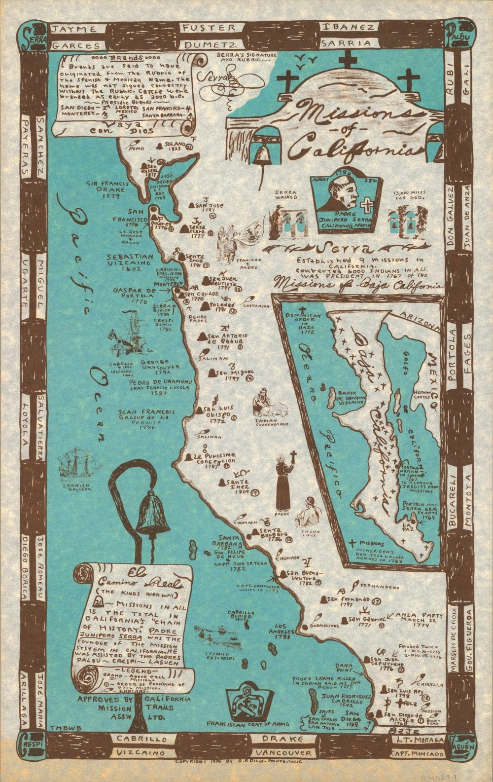
Missions of California by California Mission Trails Association
Author: California Mission Trails Association; Dicus, Garner Parker
Date: 1954
Short Title: Missions of California
Publisher: G.P. Dicus
Publisher Location: Puente, Calif.
Type: Separate Map
Full Title: Missions of California. Approved by California Mission trail Ass’n. Ltd. Copyright 1954 by G.P. Dicus -Puente, Calif. TMBWB. (inset) Missions of Baja California.
Pub Note: Pictorial map by Garner Parker Dicus, showing the location and date of the founding of the California Missions. Included on the border and the map are names and dates of early California explorers. Includes notes on Brands on the upper left and El Camino Real (The Kings Highway) on the lower left, Serra’s signature and Rubric at the upper center, vignette of Padre Junipero Serra, American Indian settlements, and legend. Notes: “Serra established 9 missions in California, converted 6000 Indians in all was president in 1767 of the Missions of Baja California”.
Pub List Number: 11072.000
Source: David Rumsey Historical Map Collection
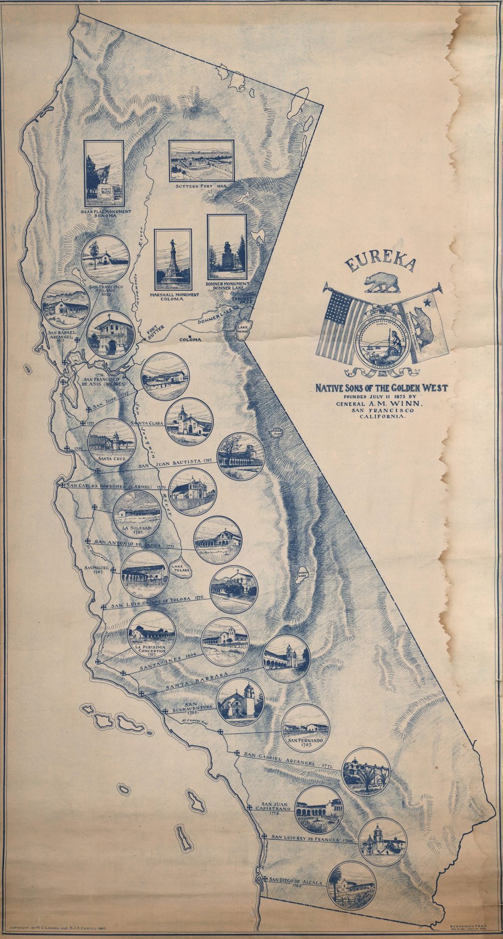
(California) Eureka by The Native Sons of the Golden West
Author: Native Sons of the Golden West; London, M.C.; Cahill, B.J.S.
Date: 1920
Short Title: (California) Eureka
Publisher: No publisher
Publisher Location: No place
Type: Wall Map
Full Title: (California) Eureka. Native Sons of the Golden West. Founded July 11, 1875 by General A.M. Winn, San Francisco, California. Copyright by M.C. London and B.J.S. Cahill. 1920.
Pub Note: The blue line map shows California with illustrations of 21 Missions and 4 Monuments.
Pub List Number: 6721.000
Source: David Rumsey Historical Map Collection
Reg Manning’s Cartoon Map of California
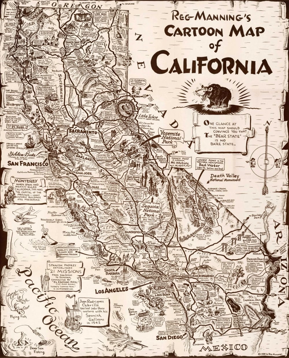
Author: Manning, Reginald W. (1905-1989)
Date: 1939
Short Title: Reg Manning’s Cartoon Map of California.
Publisher: J. Augustin
Publisher Location: New York
Type: Separate Map
Full Title: Reg Manning’s Cartoon Guide of California. J.J. Augustin Publisher. New York City.
Pub Note: Reg Manning was a prolific illustrator writing several cartoon guides and his editorial cartoons were syndicated in as many as 170 newspapers. He won a Pulitzer Prize for Editorial Cartooning. First edition.
Pub List Number: 8765.000
Source: David Rumsey Historical Map Collection
California by Jo Mora (1876-1947)
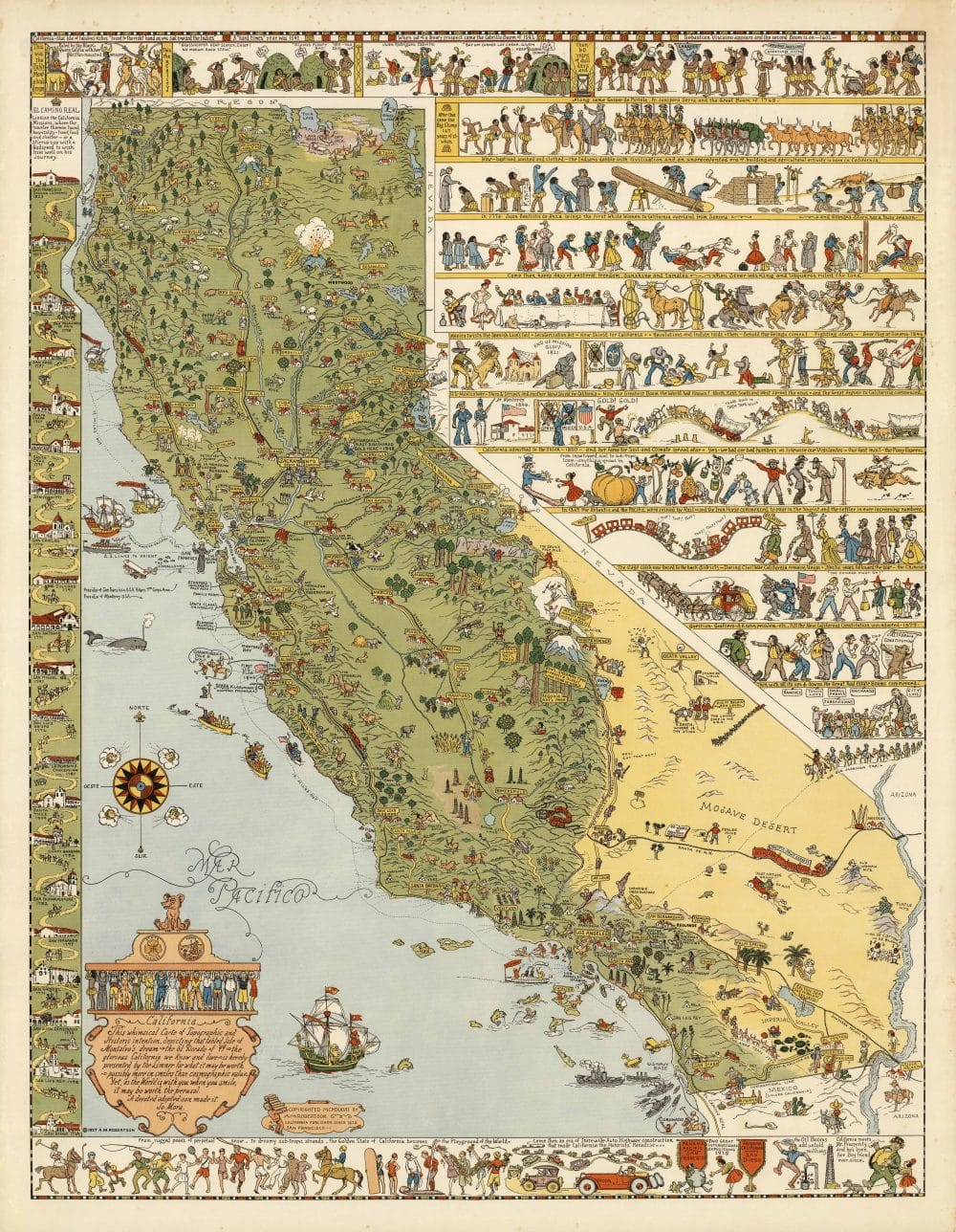
Author: Mora, Jo (1876-1947)
Date: 1927
Short Title: California
Publisher: A.M. Robertson
Publisher Location: San Francisco
Type: Separate Map
Full Title: California. This whimsical Carte of Topographic and Historic intention… A devoted adopted son made it. Jo Mora. Copyrighted MCMXXVII by A.M. Robertson, California Publisher Since 1870. San Francisco.
Pub Note: Color pictographic map, with decorative border. Jo Mora’s first map of California (see his second California map of 1945, our 6380.000. For more information on Jo Mora’s life and works, see https://jomoracollection.org.
Pub List Number: 8560.000
Source: David Rumsey Historical Map Collection
California, the Golden State by R.T. Aitchison
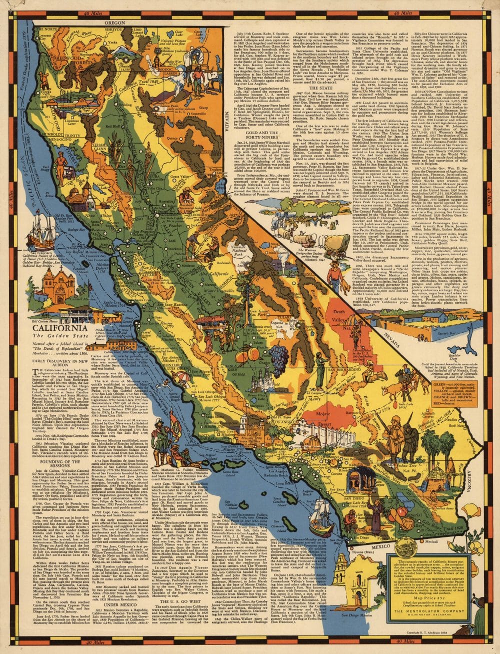
Author: Aitchison, R.T.; Mentholatum Company
Date: 1938
Short Title: California, the Golden State.
Publisher: The Mentholatum Company
Publisher Location: Wilmington
Type: Separate Map
Full Title: California, the Golden State.
Pub Note: Color & abundant text. Read the full transcript of the text on the map.
Pub List Number: 9514.000
Source: David Rumsey Historical Map Collection
Map of the Californias by Morse, Sidney E. and Breese, S.
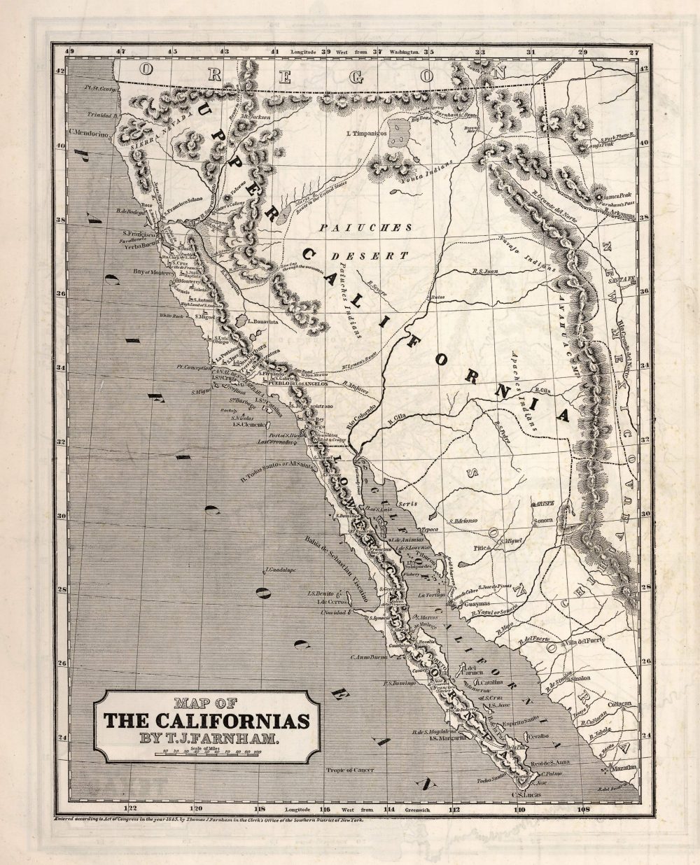
Author: Morse, Sidney E. (Sidney Edwards), 1794-1871; Breese, S.
Date: 1845
Short Title: Map of the Californias
Publisher: Sidney E. Morse & Co.
Publisher Location: New York
Type: Atlas Map
Full Title: Map of the Californias; by T.J. Farnham. (to accompany) Supplement To The New-York Observer. The Cerographic Atlas Of The United States. No.3. 1845. Entered … 1845, by Sidney E. Morse and Samuel Breese … New-York.
Pub Note: Uncolored map. Shows settlements, roads, railroads, rivers, missions, Farnham and Dr, Lyman’s routes, etc. Relief is shown by hachures. Prime meridians are Greenwich and Washington. The first Cerographic Atlas of the United States. Issued in three parts (although Woodward states that it cannot be determined how many parts were issued, our copy indicates three parts), this set includes the first part with original yellow paper covers with a detailed explanation of the publishing plan to issue the atlas in parts, and an explanation of the Cerographic Process, and the other two parts with printed covers with advertisements on verso of front covers and back covers. The maps are printed on both sides of a sheet and are uncolored. This was issued as a supplement to the New York Observer in 1842, 1843, and 1845. In 1845 it was republished as Morse’s North American Atlas, with some changes to the maps and the addition of color. Covers of parts 1 and 3, have a copyright date of 1841. When complete, this edition has 32 maps, four less than the 1845 edition, but including a map of Oregon and a map of Iowa not found in the 1845 edition. The Maine map in this edition is very different from the 1845 edition because it does not show the boundaries of the treaty of 1842; the separate map of Iowa, showing the early formation of eastern counties, is not present in the later edition which has only the map of Iowa and Wisconsin. The Oregon map is derived from Wilkes’ Map of the Oregon Territory (almost a copy, actually). This atlas is seldom found in the original three parts. According to Ristow, the Map of Connecticut originally appeared in the June 29, 1839 issue of the New York Observer, as an example of the Cerographic process, along with Morse’s announcement that additional maps would be published to form an atlas.
Pub List Number: 4180.000
Source: David Rumsey Historical Map Collection
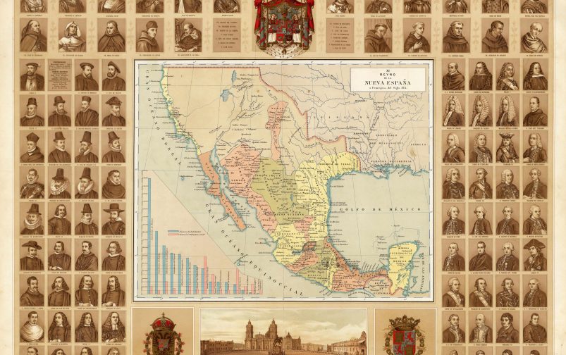
Reyno de la Nueva Espana a Principios del Siglo XIX by A. G. Cubas
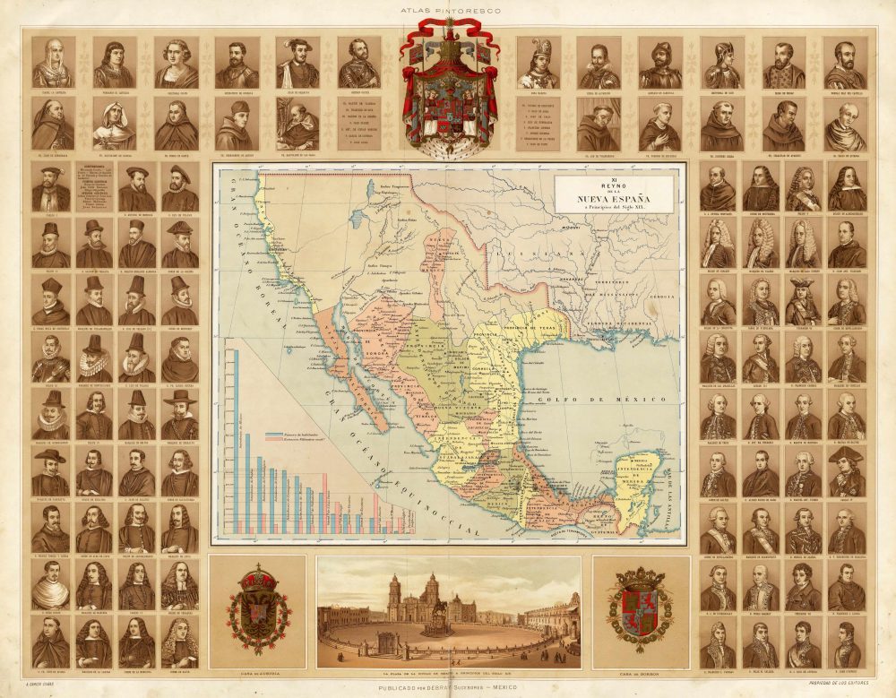
Author: Garcia Cubas, Antonio, 1832-1912
Date: 1885
Short Title: Reyno de la Nueva Expana a Principios del Siglo XIX.
Publisher: Debray Sucesores
Publisher Location: Mexico
Type: Atlas Map
Full Title: Reyno de la Nueva Espana a Principios del Siglo XIX. XI. A. Garcia Cubas; Atlas Pintoresco E Historico De Los Estados Unidos Mexicanos Por Antonio Garcia Cubas. Propiedad De Los Editores. Publicado Por Debray Sucesores Mexico 1885.
Pub Note: The maps and illustrations bordering them are superb. Garcia Cubas was the preeminent Mexican cartographer of the 19th century. Full color. Bound into quarter leather tan cloth covered boards with “Atlas Pintoresco E Historico De Los E. U. Mexicanos Por Antonio Garcia Cubas” stamped on the front cover.
Pub List Number: 2693.000
Source: David Rumsey Historical Map Collection
Map Of The United States And Mexico by Ensigns & Thayer
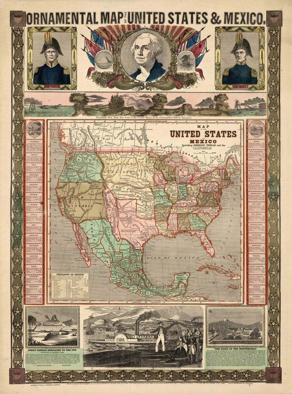
Author: Ensigns & Thayer
Date: 1848
Short Title: Map Of The United States And Mexico
Publisher: Ensigns & Thayer; Sowle & Ward; Rufus Blanchard
Publisher Location: New York; Boston; Cincinnati
Type: Separate Map
Full Title: Ornamental Map Of The United States & Mexico. Map Of The United States And Mexico Including Oregon, Texas, and the Californias. Entered … 1848, by Ensigns & Thayer … New York. Published by Ensign & Thayer, 50 Ann Street New York. And 12 Exchange St., Buffalo. Sowle & Ward, 43 Cornhill, Boston. Rufus Blanchard: Cincinatti.
Pub Note: Compare to 1846, ’47 Ornamental Map by H. Phelps. This copy is the same as the Streeter 3872, but a slight variant of the Wheat Gold 38 (Changes in the Cincinnati, Boston, and Buffalo addresses). Wheat suggests that the map is a cerograph or a woodcut – we believe it is a cerograph. This piece celebrates the U.S. victory over Mexico and shows graphically the growth of U.S. territory from coast to coast. Views of the Contemplated Oregon Railroad from New York to the Pacific Coast, Portraits of Generals Taylor and Scott, etc. A table of Distances in Mexico is in the lower right corner of the map. Rufus Blanchard’s name appears in the lower left under the Great Temple. There was an edition of 1855 by Ensign, Bridgman, and Fanning (see our copy and see Streeter 3892 for 1854, also by EB&F). Full color.
Pub List Number: 2914.000
Source: David Rumsey Historical Map Collection
